Latest flooding information and advice – 8.00pm 22 February 2022 last updated
Updated:8.00pm Tuesday 22 February
Shropshire is in the middle of severe flooding across the county as the fallout from Storm Franklin continues to cause disruption across the region.
Homes and businesses are flooded, while many roads and car parks in Shrewsbury and Bridgnorth are closed.
We have opened a flood reception centre in Shrewsbury at Salvation Army, Salters Lane, Coleham; and in Bridgnorth one will open at 9am on Wednesday at Castle Hall, West Castle Street. They will offer advice and support to those who need it.
Our community wellbeing outreach team are also out in both Shrewsbury and Bridgnorth
The Darwin and Riverside Centres in Shrewsbury are closed, with a decision to be taken on Wednesday morning to see if they can be reopened then.
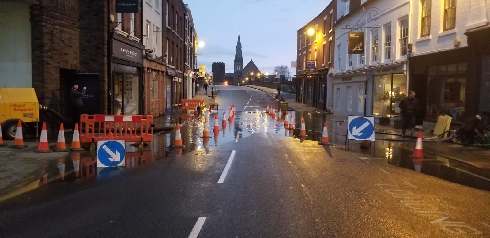
The bottom of Wyle Cop looking towards English Bridge on Tuesday morning
At 4.15pm there were 12 Flood Warnings and nine Flood Alerts which have been issued by the Environment Agency, instructing those living near the county’s watercourses to take action or be prepared for flooding.
Shrewsbury Bus Station remains closed.
Shropshire Council’s highways teams are working around the clock to close roads and car parks and make sure people who need them have sandbags to protect their homes and businesses.
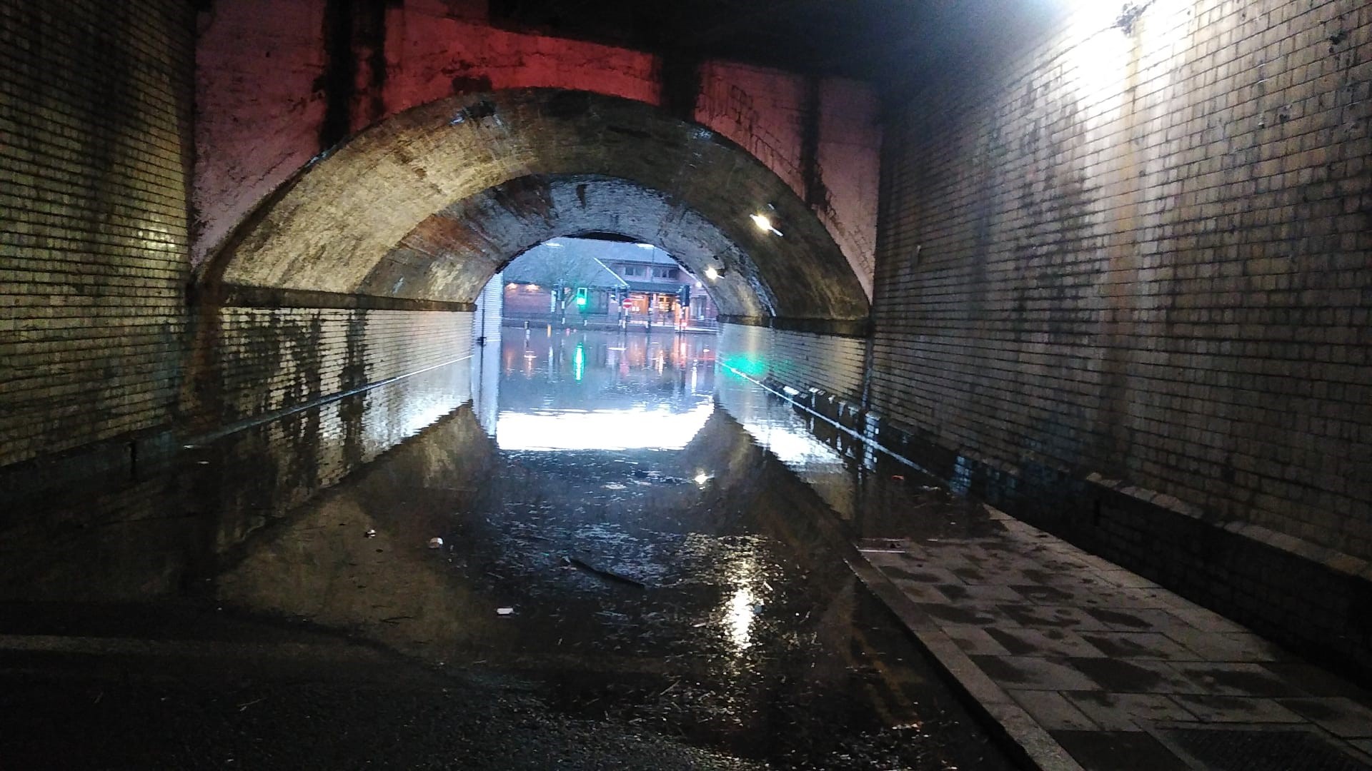
Flood water under the railway bridge in Shrewsbury
Here’s the latest information from around the county, although things are changing quickly:
Bridgnorth and surrounding areas
A flood warning was issued for the River Severn at Bridgnorth, Quatford, Hampton Loade and Highley.
In Bridgnorth properties on Severnside, Severn Terrace, Riverside and caravan parks, as well as properties in and around Hampton Loade and Highley may be affected.
The predicted peak at Bridgnorth is between 5.2m and 5.4m which is expected to hit on Wednesday morning (23 February).
At 4.15pm on Tuesday it was 5.01m.
Road closures
- Footpath from Bylet to Wellmeadow
- Southwell Riverside
- Severnside South Road and The Boat Yard
- Doctors Lane
- Severn Terrace
- Quayside
- Riverside and Friars Street
- A442 – Telford to Bridgnorth (Upstream of Bridgnorth and Fort Pendlestone)
- A442 – between Sutton Maddock island and Bandon Arms island
Car Park closures
- Riverside car park
- Riverside West elevated car park
Any displaced resident permit holders holding a valid permit may park on Innage Lane Car Park or Severn Street Car Park during the road closures.
Llanymynech and surrounding areas
A flood warning was issued for the River Vyrnwy at Maesbrook, Melverley and Llanymynech. River levels here peaked yesterday evening (Monday 21 February 2022) at Crew Green but remain high.
Flooding has affected properties and roads in and around Melverley and Maesbrook, including Melverley to Melverley Green and Ponthen to Melverley roads.
Shropshire Fire and Rescue Service successfully rescued 14 people and four dogs from their homes on Monday.
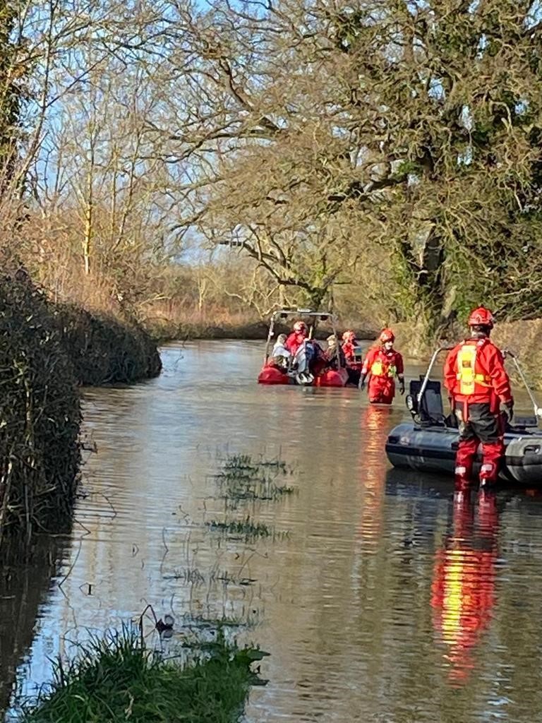
Firefighters at work in Melverley
Ludlow
This flood warning has now been removed. River levels are falling, but still pose a flood risk. However, a flood alert remains in force for the wider area, so flooding may still affect roads and low lying land.
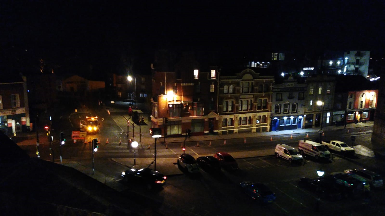
Shrewsbury on Monday evening.
Shrewsbury
A major operation is under way in Shrewsbury with the river level at the Welsh Bridge gauge peaking at around 5.15m on Tuesday morning.
Roads
With river remaining high, the council has closed a number of roads and getting ready to close others, including:
- Gravel Hill Lane
- Longden Coleham
- Coleham Head
- Smithfield Road
- Coton Hill
- Chester Street/Cross Street
- Sydney Avenue
- Atcham to Cross Houses and Chiltern Farm Lane
- Coleham Head Lane Closure into Town Centre
- Berwick Road
- Old Coleham
- Victoria Avenue
- Williams Way
- Raven Meadows at the Roushill side
- Roushill
- Cressage to Eaton Constantine
- Atcham to Berwick Wharf
- B4380 Shrewsbury to Atcham
- Castle Foregate
- Wyle Cop and English Bridge to Gyratory – to close imminently
Footpath closures
- Greyfriars Bridge to The Weir
- The Pig trough to West Midland Showground
- New Street to The Stew/Frankwell Riverside Car Park
Bus station
Shrewsbury bus station is closed due to flooding.
Temporary bus terminus drop off/pick up points are now at:
- New Park Road near Beacalls Lane
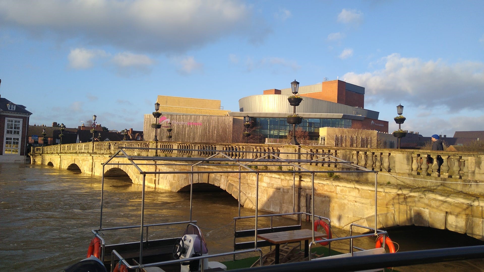
- Outside Theatre Severn
- Abbey Foregate
Shopping Centres
The Darwin and Riverside Centres are both closed on Tuesday.
Welsh Bridge on Monday afternoon before it peaked at 5.15m
Car parks
If you are thinking of driving into the town centre, please use the Park & Ride Services instead.
- Frankwell Riverside Car Park – closed due to occupation by our partner the Environment Agency.
- Frankwell Main Car Park – closed until further notice.
- St Julian’s Friar’s Car Park – closed until further notice.
- Raven Meadows multi-storey – closed until further notice.
- Abbey Foregate – closed until further notice.
The council is urging people to only travel if they need to and not to, under any circumstances, enter flood water.
Barriers have gone up in Coleham.
Get the latest updates:
- Sign up to the latest weather updates on from the Met Office Met Office (govdelivery.com)
- Find the latest on traffic information and road closures at Traffic information and road closures | Shropshire Council
- Be prepared for flooding Be prepared for flooding | Shropshire Council
- For further flood information and advice visit Drainage and flooding | Shropshire Council
- Sign up to flood warnings at Sign up for flood warnings – GOV.UK (www.gov.uk)
- Follow Shropshire Council on:
- Twitter @shropcouncil
- Facebook at Shropshire Council
- Instagram @shropshirecouncil
- NextDoor
- Shropshire Council newsroom
Report a fallen tree
- To report a fallen tree that is blocking or partially blocking a road, please call 0345 678 9006. For more information visit Report a highways fault or concern | Shropshire Council