Surface dressing programme underway in drive to improve county’s roads
More than 50 stretches of road across Shropshire are being treated as part of Shropshire Council’s annual surface dressing programme – work that will play a key role in the council’s drive to improve the county’s roads.
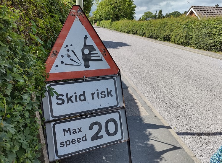
Surface dressing is a quick, efficient and cost-effective way of preventing potholes, maintaining skid-resistance and waterproofing road surfaces.
It forms a major part of the council’s annual road maintenance programme and is being carried out alongside other preventative and reactive maintenance work.
The 2021 surface dressing season began on 9 June with work being carried out until August.
The 52 sites identified for treatment (listed below, and in greater detail on the council’s website) are located across the county and include all types of road, from urban cul-de-sacs to major ‘A’ and ‘B’ roads.
The work covers approximately 819,000 square metres of road.
Roads treated so far include the B5068 Ifton Heath To Cross Lanes, Dudleston Heath; Birch Road, Tetchill; Deermoss, Whitchurch, and Church Street, Hodnet.
Steve Charmley, Shropshire Council’s Cabinet member with responsibility for highways, said:
“As well as improving and protecting our roads, this important programme of work plays a crucial role in helping to prevent potholes and other defects forming in the future. Pothole treatment is very much about prevention as well as cure and this is one important way that we can aim to prevent potholes forming next winter.”
Surface dressing involves applying and rolling aggregate ‘chippings’ onto a bitumen binder.
It will seal the surface, improve surface texture and prolong the life of the road by many years.
Further information
Due to the limited width of the majority of identified roads, over 90% of the sites will unfortunately require a temporary road closure for the works to be carried out safely.
Where road closures are not necessary, other forms of temporary traffic management will be in place, including temporary signals where appropriate. When treating cul-de-sacs limited access will be available.
For the majority of ‘A’ and ‘B’ roads centre line studs/cats’ eyes also need to be removed and replaced under a temporary closure. It’s envisaged that stud/cats’ eye removal will take place overnight between 8pm and 6am, followed by dressing, sweeping and reapplying road markings during daytime hours.
The replacement of studs and road markings on some sites may necessarily need to take place up to ten days later.
In reality, most of the road closures will only be required for a few hours for the dressing operation, and are unlikely to be of more than one day in duration.
The programme of work may alter due to wet weather or other unforeseen events.
In order to keep affected residents and road users informed of when and how long closures will be in place advance information signs will be positioned on each site in the weeks preceding proposed commencement of works.
Due to the current restrictions and concerns surrounding the coronavirus pandemic, and in order to safeguard both operatives and vulnerable people, the decision has been made to suspend the usual practice of delivering letters to directly-affected properties, so the advice is to call 0345 678 9006 for any specific enquiry, and also to view the updated detail available on the website and via social media.
Surface dressing sites 2021
North area
- B5068 Ifton Heath To Cross Lanes, Dudleston Heath
- Birch Road, Tetchill
- Deermoss, Whitchurch
- B4397 From Burlton A528 to B5063 Horton, Loppington
- Aston Bridge to B5063 Crossroads, Aston
- Church Street, Hodnet
- Lightwood Junction to Haywood Lane Junction, Cheswardine
- Staffordshire county boundary Doley to Marsh Lane Junction, Cheswardine
- Chain Lane Junction to Oswestry Road Junction, Tref Ar Clawdd
- A495 Boot Street, Whittington
- A528 Grange Road, Ellesmere
- A41 Heath Road, Prees Heath
- End of Twmpath Lane to Junction With B5009, Gobowen
- Trepennal to Tramway Farm, Llynclys
- Prospect Road, Market Drayton
South area
- A4169 Innage Road, Shifnal
- Cranmere Junction to Springhead Coppice Junction, Stableford
- B4364 From Clee Brook Bridge to Lower Faintree, Faintree
- South Road, Ditton Priors
- Monkhall to Muckley
- Stottesdon Road Junction with Blundel Farm to Brooksmeeting, Chorley
- Station Road, Stottesdon
- High Lane Junction to Bromdon Cottage Junction, Bromdon
- A4117 High Street, Cleehill
- Dinham, Ludlow
- Linney, Ludlow
- Maple Close, Ludlow
- Hamlet Road, Ludlow
- Stud Farm Junction to Sparchford, Culmington
- B4368 former Bridgnorth District Council boundary to Poplars Farm, Shipton
- Soudley Cottage Junction to Chelmick Road Junction, Soudley
- Harton Hollow Way, Wolverton
- B4385 County Boundary Marlow to Redwood Lane Junction Three Ashes, Hopton Heath
- Glebe Cottage Junction to St Marys Church Junction, Bucknell
- Chestnut Meadow, Bucknell
- B4385 Redwood Lane to B4368 Junction Purslow, Twitchen
- B4385 Red House Bridge Junction to Junction A488 Bishops Castle, Lydbury North
- Butts Cottage to The Row, Colebatch
- Kerry Lane, Bishops Castle
- Oak Meadow, Bishops Castle
- A488 Love Lane, Bishops Castle
- B4385 County Boundary to Heblands Bank, Lower Broughton
- A488 From The Marsh Junction to Gravelsbank Junction, Gravelsbank
- A4117 Junction With B4364 to Snitton Lane Junction, Henley
- A41 Albrighton By-Pass, Albrighton
- A41 Pickmere Roundabout to Kings Street Weston Heath, Crackleybank
Central area
- Stiperstones to Plox Green, Snailbeach
- A458 at Fox Farm, Snailbeach
- A458 Wenlock Road, Shrewsbury
- A488 Hanwood Road, Lower Edgbold
- A458 Welshpool Road, Bicton Heath
- Bow Way, Bomere Heath