Latest flooding information and advice – 20 February 2022 at 7.30pm
Storm Eunice and subsequent heavy rainfall is continuing to cause severe disruption across the county, leaving many roads impassable and homes and businesses flooded.
A total of 11 Flood Warnings and 12 Flood Alerts have been issued by the Environment Agency over the last few hours, instructing those living near the county’s watercourses to take action or be prepared for flooding.
Shropshire Council’s highways teams are working around the clock to close roads and car parks and make sure people who need them have sandbags to protect their homes and businesses.
Here’s the latest information from around the county, although things are changing quickly:
Bridgnorth and surrounding areas
A Flood Warning was issued earlier on Sunday for the River Severn at Bridgnorth, Quatford, Hampton Loade and Highley. River levels are still rising and will most likely remain high for the next few days.
In Bridgnorth properties on Severnside, Severn Terrace, Riverside and caravan parks, as well as properties in and around Hampton Loade and Highley may be affected.
Sandbags can be picked up at any time at the front of the council’s depot at Stanley lane, Bridgnorth, WV16 4SF.
A number of road closures are planned for low lying areas of Bridgnorth early next week.
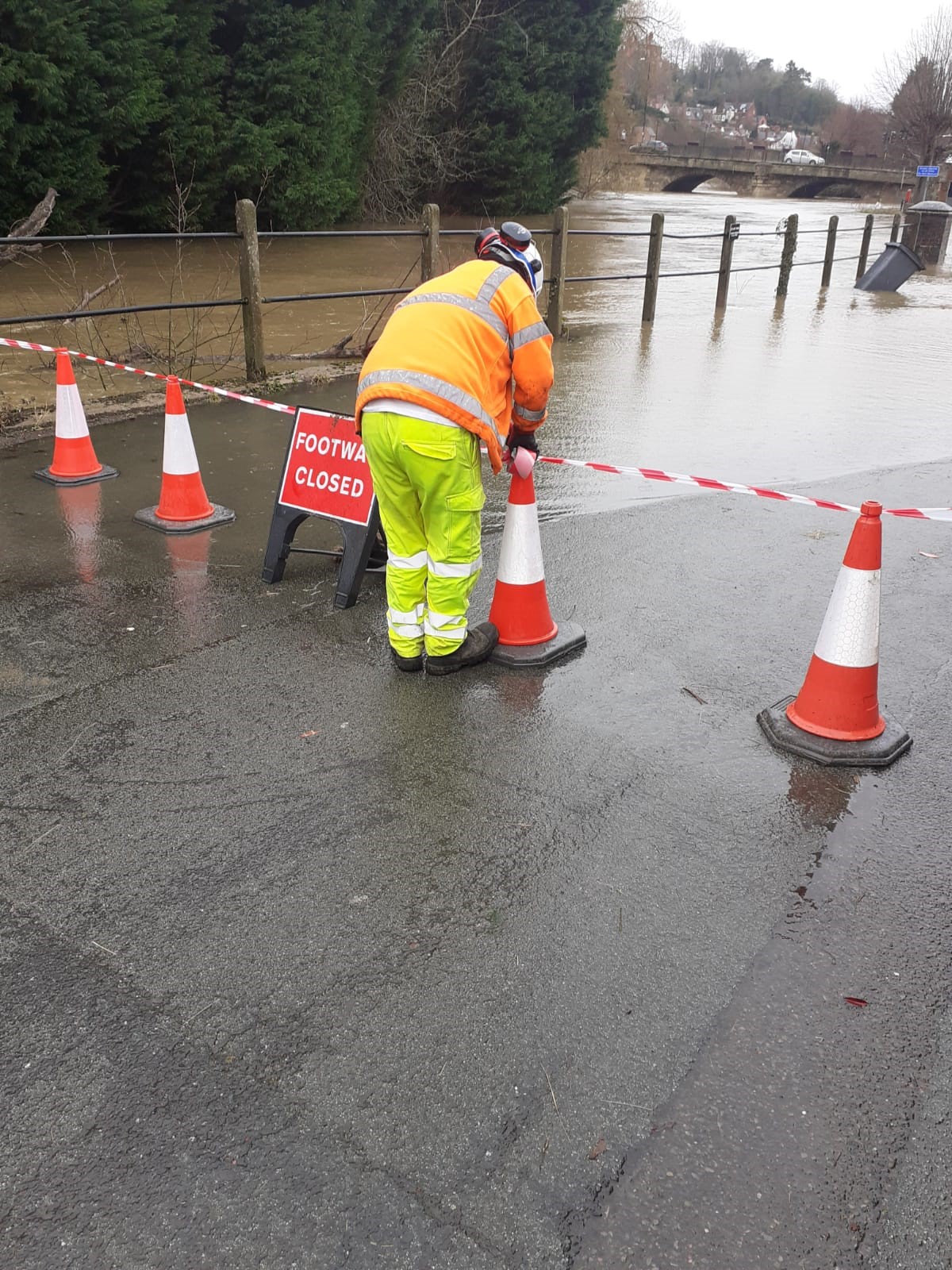
A footway is closed earlier today (Sunday) due to rising river levels.
Llanymynech and surrounding areas
A Flood Warning was also issued earlier for the River Vyrnwy at Maesbrook, Melverley and Llanymynech. River levels here too are continuing to rise.
Flooding is expected to affect properties and roads in and around Melverley, including Melverley to Melverley Green and Ponthen to Melverley roads. Flooding to properties and roads is also expected in and around Maesbrook.
The following roads could be affected by flooding:
- B4398 near the canal at New Bridge, Llanymynech.
- A483 between Llanymynech and Four Crosses, just south of Llanymynech Bridge.
Shrewsbury
Roads
With river levels rising, the council is currently closing a number of roads and getting ready to close others, including:
- Berwick Road, Old Coleham and Victoria Avenue.
- Longden Coleham (closed from 9pm on Sunday).
- Coleham Head (will close at 7am tomorrow morning (Monday) to allow the Environment Agency to deploy the flood barriers at Coleham Head).
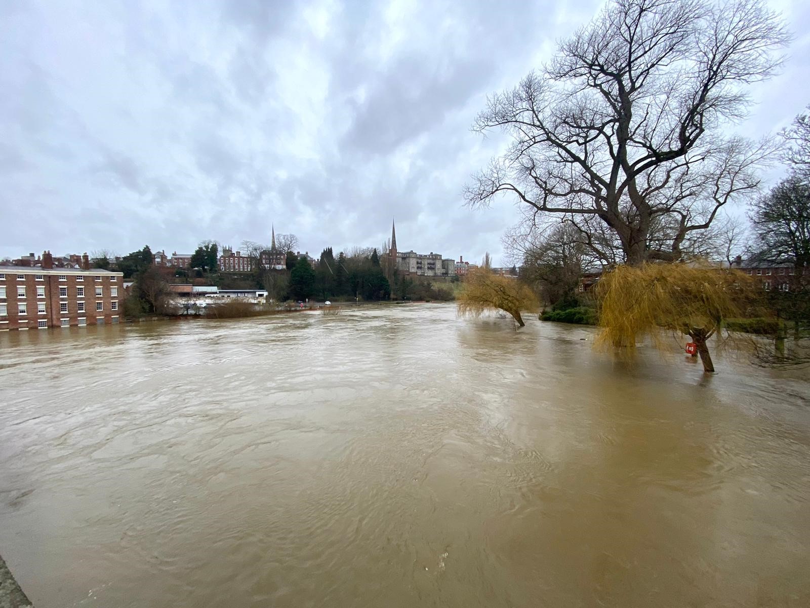
A view of the flooded River Severn from the English Bridge in Shrewsbury.
Sandbags
Sandbags can be collected from:
- Outside the Spar in Coleham.
- Smithfield Road.
- Chester Street.
If supplies run out at any of these places, more sandbags are available at the council’s Longden Road depot, Shrewsbury, SY3 9EL.
Car parks
- Frankwell Riverside Car Park – closed due to occupation by our partner the Environment Agency.
- Frankwell Main Car Park – closed until further notice.
- St Julian’s Friar’s Car Park – closed until further notice.
There are a number of cars still parked in St Julian’s Friar’s Car Park and people are being asked to remove them urgently. Also, there are some cars parked on a private road near Telephone House – these too will need moving.
The council is urging people to only and travel if they need to and not to, under any circumstances, enter flood water.
Keep updated
For information and advice on preparing for floods and current river levels, people are encouraged to check out the council’s ‘be prepared for flooding’ and ‘live flooding information’ pages.