Planning application submitted for Shrewsbury North West Relief Road
A planning application for the Shrewsbury North West Relief Road (NWRR) is being submitted by Shropshire Council today (Friday 19 February 2021).
The proposed road’s application says it would reduce journey times, traffic congestion, pollution and noise in Shrewsbury and in a number of surrounding communities, as well as helping to accommodate planned economic growth.
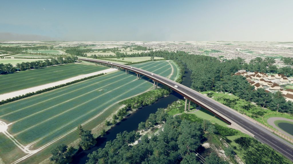
If approved, the NWRR would provide a new, single carriageway road linking the northern and western parts of Shrewsbury, with new bridges over the River Severn and its flood plain and the Shrewsbury-Chester railway line.

Shrewsbury North West Relief Road viaduct
The NWRR would connect the A5 at Welshpool Road roundabout west of Shrewsbury to the Ellesmere Road roundabout to the town’s north.
The planning application does not include a water management scheme as part of the bridge over the River Severn, and is for the road only.
The application shows that the NWRR would:
- Cut journey times by up to 14 minutes for drivers travelling through or across Shrewsbury.
- Compared with the current southern A5 route around the outskirts of Shrewsbury, the NWRR would provide a direct, high speed link across the north of the town.
- The road would also reduce traffic in Shrewsbury town centre, helping to improve air quality and to encourage more people to walk or cycle, and further support the town’s wider regeneration.
- Reduce traffic at peak-time bottlenecks on the A5 such as Dobbie’s Island and on the B4397, a well-known ‘rabbit run’ route that affects communities including Baschurch, Ruyton-XI-Towns and Walford Heath.
- Boost the county’s businesses and economy through reduced journey times and improved road links.
- Create a new circular walk by joining walking routes together; and create an additional 7km of public rights of way, giving more access to green space.
Steve Davenport, Shropshire Council’s Cabinet member for highways and transport, said:
“I’m pleased that the application is has being submitted and we are moving on to the next phase.
“It’s been an extremely long journey – one which has taken nearly 30 years. It’s a very complex and technical application, and a huge amount of work has gone into getting it to this point.
“Although we’ve carried out many consultations over the years and we continue to have conversations with stakeholders and landowners, this application is a vital next step and will allow the whole community to give their views on it.”
Due to the number of supporting documents, it is expected that the application will go live on the planning portal on Monday 1 March 2021, at which point residents and businesses will be able to give their views on the scheme.
The cost of constructing the NWRR is estimated to be £87.1m. In March 2019 the Department for Transport awarded £54m towards the construction of the road, and the Marches LEP have awarded £4.2m (for the section formerly known as the Oxon Link Road); and the council will provide the balance of the cost through developer and other contributions.

